Breathtaking 4K Drone Footage Will Inspire Any Wyoming Heart
In the video below you'll see Flying Wyoming--Chapter 1 (UltraHD) DJI Phantom 3 Professional. Yes, that's right, a professional's bird's eye view brought to you.
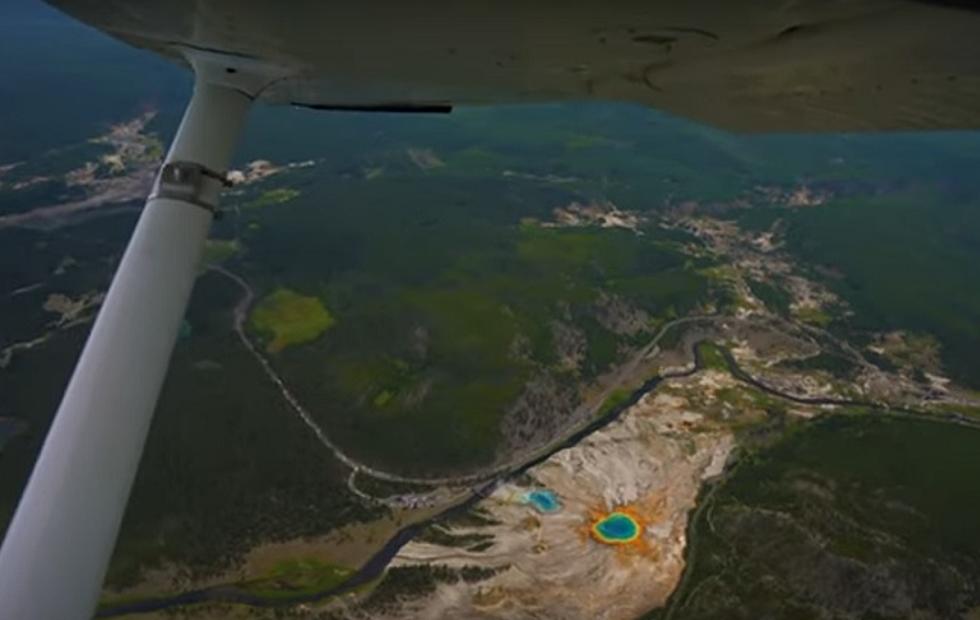
On his YouTube page, Tim Doolin Photography uses Ultra HD footage from some of the rugged byways of Wyoming, featuring such locations as the Pitchfork Ranch, Circle Park, Bighorn Mountains, Sunlight Basin, Pilot Peak, Beartooth Highway, Tie Flume, Phelps Mountain Road, Frank's Peak, Sunlight Creek Canyon, Absaroka Mountains, Brooks Lake, Shell Falls, and Beartooth Butte.
Captured from the aerial perspective of a DJI Phantom 3 Professional drone, this video celebrates the wild and rugged landscapes of Wyoming.

This first in the video series take high resolution video set to beautiful music to remind viewers of why they love Wyoming. Not like we really needed the reminder, but there it is.
Shot over time and different elevations you'll see summer grass, fall leaves, and snow. A low running shot of spring flowers was, in my mind, inspiring.
Views of famous highways, ranches and farms, canyons, and forgotten places that will make you wonder, where is that and how can I get to it?
After watching this first video it is worth going to the YouTube page to see where else this drone has been that, perhaps, even the most experienced Wyoming traveler does not know about.
Meet The Creator Of Wyoming's Most Iconic Rodeo Posters
Hulett's Rogues Gallery Astounding Western History Collection
More From 104.7 KISS-FM